

Indigenous Peoples Atlas of Canada

وصف لـIndigenous Peoples Atlas of Canada
The Indigenous Peoples Atlas of Canada, produced by The Royal Canadian Geographical Society in partnership with the Assembly of First Nations, Inuit Tapiriit Kanatami, the Métis Nation, the National Centre for Truth and Reconciliation and Indspire, the Indigenous Peoples Atlas of Canada shares the stories, perspectives, voices and history of the Indigenous Peoples of Canada. It includes historic and contemporary maps and explores themes of language, demographics, economy and culture. Important topics such as treaties and residential schools are covered in-depth, as well as the contributions of Indigenous Peoples, their oral traditions and land-based knowledge.
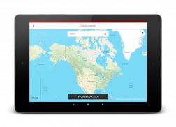
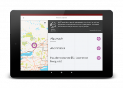
A territorial or land acknowledgment is a centuries-old tradition among Indigenous Peoples, and is also today an important part of Canada's reconciliation process — it is becoming common for non-Indigenous people to make such acknowledgments at public events and in schools.
أطلس السكان الأصليين في كندا، التي تنتجها الجمعية الجغرافية الملكية الكندية في شراكة مع جمعية الأمم الأولى، الاسكيمو Tapiriit Kanatami، والملونين الأمة، والمركز الوطني للحقيقة والمصالحة وIndspire، أطلس السكان الأصليين في كندا يشارك القصص ووجهات النظر والأصوات وتاريخ الشعوب الأصلية في كندا. ويشمل الخرائط التاريخية والمعاصرة ويستكشف موضوعات اللغة والتركيبة السكانية والاقتصاد والثقافة. وتغطي مواضيع هامة مثل المعاهدات والمدارس الداخلية في العمق، فضلا عن مساهمات الشعوب الأصلية والتقاليد الشفوية والمعرفة القائمة على الأرض.
والاعتراف الإقليمي أو الأرض هو تقليد منذ قرون بين الشعوب الأصلية، وأيضا اليوم جزءا هاما من عملية المصالحة كندا - أنه أصبح من الشائع بالنسبة للأشخاص غير السكان الأصليين لجعل مثل هذه الاعترافات في المناسبات العامة والمدارس.


